Skip to content

The Sierra y los Cañones de Guara Natural Park is full of geological treasures. You don’t need to be an expert in this field to enjoy magical places such as the Salto de Roldán, in Sabayés, with the stunning Flumen River Gorge; the Ligüerri Mallos, in Vadiello; the Mascún Gorge, which can be reached from Rodellar; or the stars of the canyoning world: the Vero, the Alcanadre and even the Guatizalema.
It is, in fact, geology that has put our region on the map.
A tour of Guara’s geological treasures
Guara’s geological treasures are everywhere, and you’ll find points of geological interest no matter where you enter the park. In fact, our first stop will be at the westernmost entrance to the Sierra y los Cañones de Guara Natural Park, in Sabayés. There you’ll find the Salto de Roldán, a sight that catches everyone’s eye, even from the city of Huesca.
The Salto de Roldán is formed by two enormous masses of conglomerate, the Peña de San Miguel and the Peña Amán, separated by the river Flumen. The Salto de Roldán has legends, trails and a great deal of interest geological and scenic. It is located less than 20 kilometres from the city of Huesca and is already at an altitude of over 1,100 metres.
Numerous walking and cycling routes pass through the area, and it is also a popular spot among birdwatchers, as it is home to a wide variety of birds, notably griffon vultures, Egyptian vultures and bearded vultures.
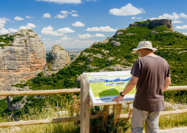
To find out more about this area and everything it has to offer, we suggest you take a look here → Espacio Salto de Roldan – Sabayés
For cycling enthusiasts and those who love challenging routes, this area deserves special attention, as it is home to one of the toughest, most complex and most beautiful routes in the entire nature reserve, which you can explore in depth on our sister website bguara.org or by clicking here https://bguara.com/ruta/enduro/integral-del-salto-de-roldan/
Gorges and canyons: the great sculptors of the landscape
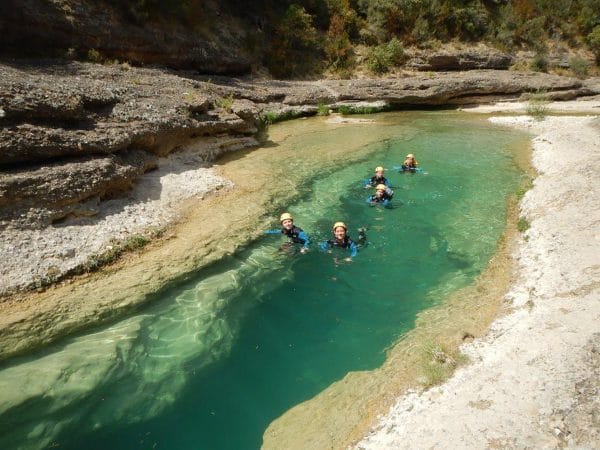
If there is one thing for which the Sierra y los Cañones de Guara Natural Park is renowned, it is its gorges. In fact, we owe much of the area’s current economic development to them, thanks to the sporting activities they offer. But beyond sport, the gorges of Guara are a paradise for geology enthusiasts.
As others have already said, they are true natural temples https://viajes.nationalgeographic.com.es/a/sierra-guara-fantasia-roca-y-agua-prepirineo-huesca_17118
The Vero River Gorge, one of Guara’s great geological treasures
But let’s head into the heart of the Sierra de Guara, specifically to its star ravine: the Vero River Canyon. We suggest starting the route at Fuente Lecina, turning off at kilometre 13.1 on the road between Colungo and Lecina.
There, at ground level, we come across a karst spring that feeds the River Vero. As the limestone dissolves, it has formed an intricate network of underground channels, which are the key to ensuring that the springs and rivers in this area carry water all year round, regardless of the aridity of some of the surrounding landscapes. We continue our route past the Molino de Lecina, the Barranco de Basender, the impressive rock shelters clinging to the cliffs, and the viewpoints at Tozal de Mallata and Portiacha.
This is where the Guara canyons begin. In fact, this area forms part of the Sobrarbe Pyrenees Geopark, the Pyrenees Geological Park, and from here you can access everything you need to start learning about the geology of this part of the park. LINK https://www.geoparquepirineos.com/descargas/gr_5.pdf
If, as well as exploring the geological features of the Vero Gorge, you want to make the most of everything this part of the park has to offer, take a look at LINK Canyoning in the Sierra de Guara
Pools, fossils and groundwater in the Sierra de Guara
The subsoil of the Sierra y los Cañones de Guara Natural Park is criss-crossed by underground channels that form a veritable labyrinth of water. We know that these labyrinths reach depths of up to eight kilometres below the surface, but from time to time the water emerges, forming wonders such as the Balced ravine, which, at 20 kilometres in length, is one of the longest in the Sierra de Guara.
Here’s a suggestion: we all tend to gaze at the impressive cliffs carved by water and wind, but have you looked at the ground? If you look closely for a few moments, you’ll see that you’re standing on fossils of what was once the seabed, mainly nummulites, which were raised along with the seabed over 40 million years ago.
Before leaving this area, we’ll reach the Saltador de las Lañas, from where we can see the entire upper reaches of the Mascún ravine. You might be surprised to see the ravine bed completely dry, but that’s the magic of this park. Various springs will gradually feed it until it becomes one of the favourite ravines for sports enthusiasts from all over the world.
As we are still within the catchment area of the Pyrenees Geopark, here is their itinerary and geological information about the most secluded and wild part of the Sierra y los Cañones de Guara Natural Park. LINK https://www.geoparquepirineos.com/descargas/gr_14_modif.pdf

Geology and stone villages in the heart of Guara
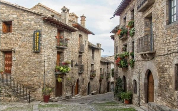
Whether you enjoy walking or fancy a ride on your mountain bike whilst discovering the geology and villages deep within the park, we recommend the “Stone Villages” route. After all, human settlement—the villages—played a decisive role in shaping our landscape.
Starting from Las Bellostas – a village with fewer than ten registered residents and even fewer actually living there – you’ll enjoy panoramic views of the geology of the Sierra y los Cañones de Guara Natural Park, as well as its flora and fauna, and get a rough idea of what life was like there not so long ago. The 14-kilometre route is perfectly suitable for cycling or walking over the course of a full day. https://www.geoparquepirineos.com/descargas/gr_14_modif.pdf
Sobrarbe and the magnificent geological landscapes of northern Guara
The Sierra y los Cañones de Guara Natural Park spans four regions: Somontano, Hoya de Huesca, Alto Gállego and, of course, Sobrarbe, where you’ll find the main geological attractions. In fact, the village of Las Bellostas belongs to this region. But it is well worth completing the tour of our region’s geology by heading towards Aínsa, the capital of Sobrarbe.
On our walk from the centre of the park, we’ll come across the Mirador del Tozal viewpoint in Guaso; the Boltaña anticline; and the impressive confluence of the Ara and Cinca rivers, which flow around the hill on which Aínsa stands. And when you visit Aínsa, here’s a little secret: look for the old river level on the town walls – it’s much higher up than you might imagine.
And here’s another secret: if you climb the stairs to the castle, take a look at the slabs on the banister, because they’re full of fossils, just like many of the slabs at the castle entrance itself. Here’s a guide to help you find your way around: https://www.geoparquepirineos.com/descargas/gr_2.pdf
Discover the geological diversity of the Sierra de Guara
Have you visited any of these places? Were you aware of all this geological diversity? Share your impressions and your walks in the mountains with us!